Saturday, August 11, 2018

Day 13: Fredenberg Creek Camp to Oberg Mountain

June 14, 2018

I thought last night would be a warm one in my hammock. When I first tucked in around 8 p.m., it was stuffy. But after a few hours it cooled down, then got cold. I put on my puffy coat and slid on my rain pants over my long underwear. I had my rain poncho as a blanket, but it didn't cover my entire body. My legs got so cold I couldn't sleep. I finally realized the plastic sheet I used to set my belongings on was actually a large trash bag; I fished it out from underneath my backpack and other belongings, then slid into it. This was kind of gross, as it was pretty dirty, being a ground cloth and all. But I was cold! And it did the trick. It warmed me so that I could fall asleep.

Despite all of the above, it was nice falling asleep in camp. I could hear various animals coming to the creek to drink. By the loudness of their splashing, I could imagine whether it was a deer, fox, raccoon, etc. 

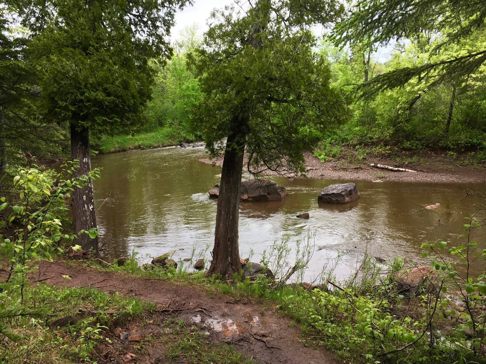
The morning was lovely. I had my coffee and breakfast, then broke camp and hiked out. The trail was very scenic along the Temperance River. As is common along this trail, there were plenty of killer waterfalls to observe. 

Because the Temperance River area is a state park, the trails were pretty well groomed, which was great. I dropped a lot of my heavy camping gear with Brian when I saw him in the park.

And then, the groundhog. Sigh. I was hiking up the other side of the river, making great time, when I spotted a groundhog in the middle of the trail. At first I was excited; I was able to photograph it before it fled.

But then the problem: it DIDN'T flee. Most wild animals will. This guy kept clicking its long front teeth at me. I wasn't sure if it was a mama protecting babies or a rabid animal. I assumed the former initially, but the animal would not move whether I yelled at it, jabbed my trekking poles toward it, backed off for a while, threw sticks at it, etc. When I tried to detour around it in the scrub, it really started clicking its teeth in earnest, and puffed out its fur.

Finally, I had no choice. I pulled out this little vial of mace Ed had given me three years ago and pushed the button. It was old and wet from many soakings through my backpack, but it worked. As soon as the red liquid hit the groundhog, it ran away. I then sprinted down the path for about 100 yards.

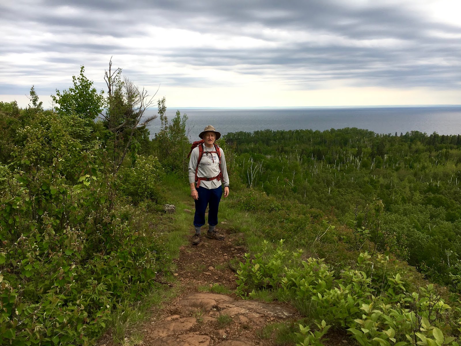
Unfortunately, that wrecked my day. It was warm anyway, and from the groundhog it was a hard slog up to Carlton Peak. The signage was poor, and by the time I reached the peak I was irritable and didn't care about the view.

I headed down the peak, knowing I had another trail segment of nearly six miles ahead of me. Luckily those miles were easy, and I made good time back to my car at the Oberg Mountain trailhead.

But I learned an important lesson. I can't keep hiking at this pace. Physically, I can. But mentally, I can't. I don't like rolling into camp (or my motel) at 7 or 8 p.m. It doesn't leave enough time to do anything other than wash up, eat quickly and go to bed. It makes me feel negatively toward the trail, and that's not fair.

So tonight I made a decision. I'm slowing down my hike, even though I'm almost finished. I will end on a positive note, not a sour one.

Snowshoe


Miles: 16
MN NCT Miles to Date: 227.9
SHT Miles to Date: 227.9
Total NCT Miles to Date: 499.6


Day 12: Crosby Manitou to Fredenberg Creek Camp

June 13, 2018


Last night got pretty cold. I had my hammock again and put on everything I had, but it wasn't quite enough. I must check the underquilt I got when I get back home. I'm not sure if I didn't get a warm enough one (it's rated to 40 degrees, but it wasn't quite that cold out) or if you're also supposed to have a down blanket as well. Luckily Brian had a down jacket he didn't need; I used it to cover my legs, and then I was fine.

This morning we had a nice breakfast, broke camp and headed our separate ways. The hike out of Crosby Manitou takes you down to the creek, and then steeply uphill. Really steeply uphill. I have the stats somewhere, but it's several hundred feet up over just a few hundred feet.

When I caught my breath and started going down the other side, I came upon another thru-hiker and his dog, George. The guy was heading southbound and had never done anything like this before. He was so excited to be bathing in waterfalls at night, camping, etc. It was fun to see his enthusiasm and excitement for doing something new to him.

Blueberry caught up to me partway through the afternoon and we hiked together for several hours, then enjoyed a snack break at a pond. He got off the trail at his campsite for the night -- I'm blanking on the name, but it was the one before Fredenberg Creek, where I was headed. Green Tortuga was somewhere behind us. He takes a lot of pictures for his website, Hike4Fun, which lets you log your steps on one of several trails, then shows you how far you'd be if you were actually hiking that trail.

I popped out on a road and had two miles left to get to my camp. I'd cheated and had Brian drop a gallon of water for me since today was a long day and I didn't want to have to filter a lot of water among the mosquitoes. Well, it took me a while to find it because there were two parking lots -- which I didn't realize at first -- so I kept wandering around the first one. But I found it and hiked two miles with that gallon. It was heavy!

The camp was cute and quiet. Fredenberg Creek wasn't that deep, but I was able to wash up fine. 

Snowshoe 

Miles: =17.5
MN NCT Miles to Date: 211.9
SHT Miles to Date: 211.9
Total NCT Miles to Date: 483.6


Thursday, July 26, 2018

Day 11: Lake County Road 6 to G. Crosby Manitou State Park

June 12, 2018

Ed left for home today after dropping me off at the trailhead. The forecast was a 30% chance of rain in the morning. It did drizzle on and off, but nothing that got me too wet, so that was nice.

Unfortunately, I did something with my backpack -- leaned it over too far, I think -- and a bunch of water leaked into the bottom of the pack and then dripped all over my shorts. So they got soaked. I stopped and took a microfiber cloth and sopped up as much water from my shorts as I could, then applied Body Glide to my inner thighs to avoid chafing. But I didn't unpack my loaded bag -- too much work.

The terrain in the morning was easy and lovely. I crossed a 440-foot boardwalk at one point; Brian took drone shots of that. I passed a 20-foot erratic, which was very cool. That might be the biggest one I've ever seen. I met two nice, young men packing up camp and interviewed them for the series, then texted Brian to meet them and take photos/videos.

Then things turned sour. In the afternoon the trail devolved into this rooty, muddy, rocky mess. The roots were so tightly entangled you had to walk on top of them, which chewed up the bottoms of your feet. It was slow going and nasty. I could barely enjoy the scenery because I had to look down and watch every single step. The only nice part was a detour off to Lilly's Island, a cute, tiny island linked to the mainland by a short boardwalk. There was a trail register on the island, which I signed; BlueBerry had already gotten there!

Late in the day I passed BlueBerry and Green Tortuga, who had set up camp at a spot called Aspen Knob. I didn't even let myself stop and chat because I just wanted to get to my camp at Crosby Manitou, and it was just ahead. GT termed the terrain we'd just come through "brutal."

My misery wasn't quite over. I thought once I got to Crosby Manitou, the campsites were just off the parking lot. So I ambled into camp, all happy that I was almost there, then took the Middle Trail, which led to my campsite #4. Brian had dropped a jug of water (9 pounds), which I decided to carry in to save time filtering.

Well, after hiking about .5 miles down the trail and seeing nothing resembling a campsite, nor hearing any water (the site was riverside), I decided I'd taken the wrong trail. So I backtracked only to discover I WAS on the right trail. Some guys drove up in a truck then, with a campground map in hand, and I learned I had about a mile's hike to my site.

So back down the trail I went (for the third time), toting that gallon of water. I finally reached the river, passed campsite #3, and then was not seeing #4. The terrain got bad again -- rocky and rooty -- and I thought I'd passed #4 while looking down. I finally found it, and Brian was there, and then I just started crying.

I was exhausted, hungry, dehydrated and mentally shot. I finally calmed down once I drank some water and took off that heavy pack. Brian helped me set up my hammock and boiled water for my dinner while I washed up. He also gave me his down jacket in case it got cold at night. It did, and thank goodness he gave me that jacket, as I used it as a blanket.

The campsite was quite lovely. I wish I had arrived there earlier, and under better circumstances, so I could have fully enjoyed it.

Snowshoe

Miles: =22 (definitely more with my backtracking)
MN NCT Miles to Date: 194.4
SHT Miles to Date: 194.4
Total NCT Miles to Date: 466.1


Day 10: Penn Road to Lake County Road 6

June 11, 2018

Today we had a hike of about 19 miles ahead of us. That's a lot! The day began wonderfully. We hiked up to Bear and Bean Lakes, a very popular destination with locals and those that know the North Shore. The views were spectacular!

After the twin lakes, we hiked up to Mount Trudee, another mountain offering impressive views, then slid down the Drainpipe. O.K., we didn't slide. The Drainpipe is a narrow, rocky chute that you have to walk down. There's a wooden railing along part of it, but the railing is about shoulder high, and leaning, so it's rather ineffective. Most of the Drainpipe you have to navigate on your own.

Once out of the Drainpipe, you enter Tettegouche State Park. Sounds great, but unfortunately the trails here were confusing and sparsely marked. We got lost a few times and probably hiked an extra half-mile or so. That might not sound like much, but it is when you're hiking 20 miles and in tough terrain.

When we got out of the park, we had a 6.8-mile stretch left. It was nearing the end of the day, so we knew we'd be hiking until 7:30. Oh well, at least it was light. We just focused on putting one foot in front of the other. 

This stretch of trail (around Wolf Rock) was actually pretty magnificent. But we were tired and couldn't enjoy it as much as we should have. The route featured many sweeping views of Lake Superior and other spots. 

About one mile before we reached the parking lot, we saw our car on the road far below. The trail led us past the car, so we knew we'd have to switch back at some point after descending from the mountain. We eventually did, but -- as Ed said -- it was a cruel move because we had to climb a bit before the final descent.

Snowshoe


Miles: 17.7
MN NCT Miles to Date: 172.4
SHT Miles to Date: 172.4
Total NCT Miles to Date: 444.1


Friday, July 20, 2018

Day 9: Split Rock River State Park to Silver Bay

June 10, 2018

An awesome sauce day! 

Ed dropped me off at the spur trail leading back to the SHT where I had gotten off last night. He then parked the car and planned to meet me up the trail a bit. It only took him an hour or two, which was pretty amazing.

But more amazing was the route today. This is finally the Superior Hiking Trail I envisioned. We climbed a lot to great rocky outcrops with expansive views of the lake. It was just incredible and indescribable. The lake was everywhere you looked. I know it's enormous, but this was just crazy cool.

We have another two nights in the motel, so we were hiking with day packs, which was a nice change of pace. We ran into one other couple about our age who were hiking for three days. There was some mud, but nothing like some of the earlier days.

My big toe hurt a fair amount, which wasn't fun. But the scenery made up for it.

Brian met us twice and took some virtual reality shots plus used the drone. We passed more beautiful waterfalls.

Oh -- one interesting encounter was with a mama grouse. She rushed out of the bushes and was squawking and flapping her wings and rushing at us. We then saw one chick duck into the undergrowth. Ah! She was protecting her babies. But she was right on the trail, and every time we tried to advance she'd rush at us. We didn't want to get bitten.

Eventually Ed took the lead and we slowly advanced. Mama rushed once or twice more, then changed tactics and folded in her wings and scurried down the path in front of us, leading us away from her nest. Fine with us! 

We're back in the motel, clean and fed and in need of a good night's sleep. Tomorrow is supposed to be a long, difficult day.

Snowshoe

Miles: =16
MN NCT Miles to Date: 154.5
SHT Miles to Date: 154.5
Total NCT Miles to Date: 426.4


Day 8: East Gooseberry Falls to Split Rock River State Park

June 9, 2018

Well, shoot! Today was supposed to be sunny. Instead, shortly after we woke up it started to rain. My phone said the rain would last until 9 or 10. Our clothes and gear were already full of mud, and this was making things much worse. We didn't want to start the day off getting soaked, so we bided our time. 

Ed, the champ, got out of the tent and made us coffee. I huddled inside and packed up our pads, sleeping quilts and everything I could. Finally we could wait  no longer and struck out around 9:30 a.m. Luckily the rain stopped shortly after. But it was cool and windy. We didn't want to risk hypothermia again, and were fed up with the mud and rain, so we decided to bag our last night's camping and booked a room at the AmericInn in Silver Bay. That made the day easier to take!

Because of our change in plans, Ed had to reconnoiter with Brian and Bob. So he stayed with them while I hiked on. After finishing Gooseberry Falls State Park, which was lovely, the trail has a temporary reroute: it runs along the Gitchee-Gami State Trail for 2.1 miles, then goes up Blueberry Hill Road for a mile before getting back on the real trail.

At the start of the reroute, I ran into two other thru-hikers: BlueBerry and Green Tortuga. Nice guys. We chatted a bit, then went our separate ways. A minute later I was looking at my map and did something -- who knows what -- and ended up falling down and wrenching the big toe on my right foot. Wonderful.

I gimped down the path and missed the turn onto Blueberry Hill Road, adding another .8 miles to my day. Then I somehow lost my hat without even realizing it. Luckily some trail runners practicing for Voyageur found it and, as they were doing an out-and-back, delivered it back to me. How sweet!

At that point I had reconnected with BlueBerry and Green Tortuga. I said the hat return was trail magic, but Green Tortuga said that kind of incident is actually called trail mail. Love it! 

The trail wound through Split Rock State Park, which was absolutely gorgeous. The path goes up one side of the Split Rock River and down the other. I hung out with Green Tortuga for most of the way, chatting about our hiking adventures and lives. 

He has a website, Walk4Fun, which lets you log your steps (if you track them) and then see where your daily mileage would get you on a famous long-distance trail like the AT or PCT. He will add the SHT to the options!

At one point in the hike, the bridge crossing the river was out. We knew this; it was posted all over. Supposedly the crossing is easy to do on rocks, assuming there hasn't been a lot of rain. The latest intel said the crossing was fine. Um, no.

When we got there, the bridge was out but there was no obvious spot to cross safely. Everyone was doing their own thing. I'm not great on crossing rushing rivers, nor hopping on stones that are far apart. BlueBerry -- a young man -- was able to nimbly hop across. I asked him to wait and make sure I got across walking through the water. Two other women hikers helped direct me as well. I made it across, but I'm not sure if I would have done it if there weren't others around.

Once on the other side of the river, I saw the campsite we had planned to stay at tonight. It was absolutely lovely. Possibly the best I've seen, based on the flat tent pads, easy access to water, lack of mud, etc. Oh well.

Ed hiked in to meet me, and as nice as that campsite was, I almost wept for joy checking into the AmericInn. There is nothing like a shower and comfy bed after four days of hiking through mud, rain, rocks and roots.

Snowshoe


Miles: =16
MN NCT Miles to Date: 138.5
SHT Miles to Date: 138.5
Total NCT Miles to Date: 410.4


Day 7: Reeves Falls Camp to East Gooseberry Falls Camp

June 8, 2018

Bob and Brian made us French press coffee this morning -- yum! Then it was time to hit the trail.

The first few hours of hiking took us through a lot of wet grass, water and mud. Ugh. But then we began climbing, and got our first few views of Lake Superior! I know it's the largest freshwater lake in the world by volume. I know how massive all of the Great Lakes are. But it is still so impressive to see her from the trail -- she is so enormous!

We also enjoyed hearing more grouse drumming and a woodpecker busily pecking away (but couldn't spot him); there were also lots of little wood frogs hopping around. We also heard a deer make this interesting whistle/snort, which I'm guessing was to scare us away from a baby.

Despite the thrill of seeing Lake Superior, this day was hard. The trail was often rocky and rooty, especially at one spot where there had been a rock slide and you had to maneuver along a narrow trail covered in slippery shale. I got a bunch of blisters today. The bottoms of my feet are killing me. 

But I did enjoy crossing the Encampment River (some wading involved) and climbing Wolf Rock, a pretty outcrop.

We had planned to camp at Middle Gooseberry Falls. There are several Gooseberry campsites in a row. When we got to Middle, one couple was already there and the remaining site was poor. Ditto with East Gooseberry Falls. We did find this outlier site near East Gooseberry and decided to take it. No place to hang my hammock so it was another night in the tent with Ed. Not that I don't love my hubby, but I find hammocks more comfortable than tents.

Since we weren't at an actual campsite, there was no fire ring or bench. The mosquitoes were bad. So after dinner, we went into the tent for an early night.

Snowshoe


Miles: =20
MN NCT Miles to Date: 122.5
SHT Miles to Date: 122.5
Total NCT Miles to Date: 394.4