Saturday, September 20, 2014

Day 4: Emstrur to Porsmork

Today's hike was great. We woke up to balmy temperatures and no wind. The main group of 5 took off a little bit ahead of us. We left before the Spaniards, per usual. I was intrigued to see how they were going to fare. They were intending to catch the 4 p.m. bus out of Porsmork back to Reykjavik (Porsmork is the official end of the Laugavegur trail), but when we left around 9:30 a.m. they were just starting to eat breakfast -- and today's hike is billed at 6 to 7 hours.

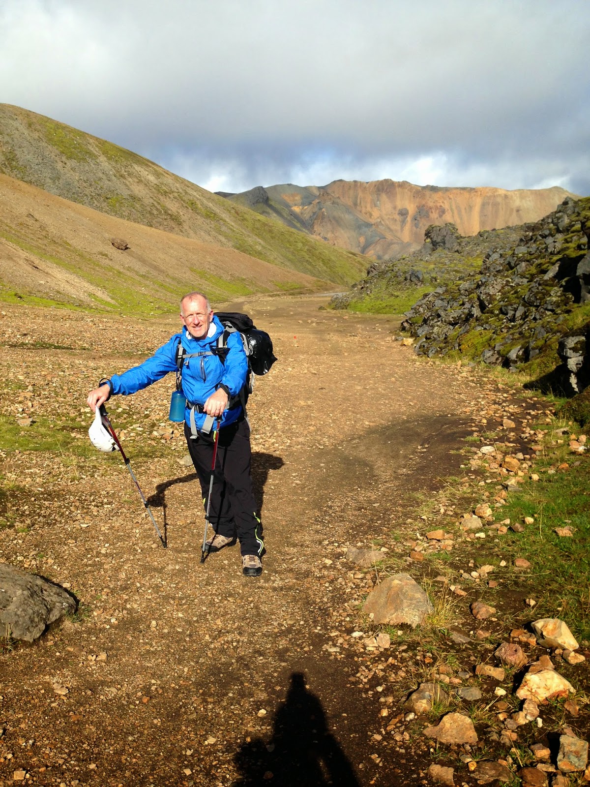
The first segment was beautiful, winding up and down the mountains and across a bridge that led to a narrow trail etched into the mountain, with a chain drilled in to help you haul yourself up. Yikes! 


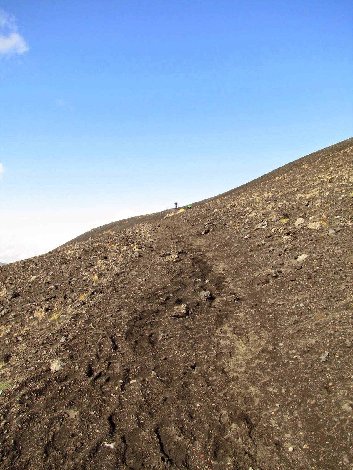
Next we spent several hours traversing a mainly flat area filled with interestingly shaped rocks and scruffy vegetation. At one point I wrote "Hola!" in the dirt and drew a smiley face, hoping the Spanish guys would see it. We finally caught up the lead pack late morning, when they had stopped to eat lunch. Apparently Eli had planned to camp on this hike, not stay in the huts (he changed his mind after his harrowing first day in the fog/wind/rain). So he had cooking equipment with him -- and there he was, making some dish over a little stove. Ha! We just stop for about 10 minutes at lunchtime -- enough time to scarf down an energy bar or PBJ.

Near the end of this stretch we had to climb a long, super-steep hill. We stopped at the top for our lunch, and were surprised to see the Spaniards walk up. They were hiking very quickly today because they were under a time crunch due to their late start. They had seen my note, and it made them laugh. :)

We quickly finished eating and joined the guys on the hike down the hill, which ended in a river ford. While we were taking off our shoes and socks, the other 5 walked up and we all crossed the river at the same time. It was quite cold, but only up to our knees.

The final portion of the trail went through a pretty forested area. Icelanders think their island originally was about 25% forested. A few years ago, only about 1% was left forested, so they began a huge reforestation effort and are now up to about 4%. So it was a surprising sight to see all of these trees.

We arrived in Porsmork to bright sunshine. The Spaniards had gotten ahead of us, and were already enjoying a cold beer when we walked up. The four Canadians were also planning to go back to Reykjavik, but they were catching tomorrow's bus, as they planned to spend much of tomorrow morning and afternoon doing day hikes (there are supposed to be lots of great ones here). Eli wanted to hike with us on the next trail, which goes to Skogar, but decided instead to go back to Reykjavik with the others tomorrow.

Porsmork has a hut, per usual, but also offers room rentals. I'd booked us in the "motel," where we had a room with a bed made up with linens, plus a common toilet and sink down the hall. It was small, but nice. We were able to shower in the main building (free, thank goodness). We did a short hike with Laurie and Barrie first.

Porsmork also has a restaurant, so the 7 of us met for dinner. We ran into Ryan and Emily there, the Canadian newlyweds we'd met on the first day. We hadn't spoken with them very much because they were camping, and the campers weren't allowed into the huts. But we pulled them into our dinner and conversation, and it was fun having a larger group. Ryan and Emily said they were also planning to hike to Skogar tomorrow like we were, so it was nice to know Ed and I wouldn't be alone.

The hike to Skogar is 10 to 12 hours long if you do it in one day. It's supposed to offer spectacular scenery, but be rather dangerous if the weather's bad, as you climb 1,000 meters and at that altitude, as Hafta said, the weather can change in seconds. For the worse. So yes, knowing we'd have Ryan and Emily hiking with us was a bit comforting.


Wednesday, September 17, 2014

Day 3: Alftavatn to Emstrur (Botnar)


Had a reasonably good sleep last night, although one of the Spaniards (I think) was snoring quite a bit. In the morning Lynn and I did some trading -- she gave me some instant coffee packets for some of Ed's mini Snickers. I can't believe we didn't think to bring coffee, tea or any kind of drink.

The bikers took off early, and the rest of us were discussing which route to take. The official route, which the hut warden said was signed, was mainly along a dirt service road. It had two river crossings. The alternate route was much prettier, but was unmarked and had three river crossings, including one called the Cold Crotch River. The hut warden said she thought that river was only up to the knees about now, but it had rained all night and was still raining, so we feared it might be rising to crotch level. Personally, Ed and I didn't like the idea of hiking an unmarked trail. We'd done a bit of that last night on the mountains and didn't care for it. I also didn't want to cross any more rivers than I had to. So we elected to take the official route with the Spaniards, while the four Canadians and Eli opted for the scenic route.


Ed and I left ahead of the Spaniards, who prefer to sleep in a tad and eat when the rest of us are out of the kitchen. Although the warden promised signage, there was none on the road. But as there was just one road, we figured we had to be going the right way. 

After an hour or so we came upon another hut (I didn't realize there was another one this close to ours). We chatted with a Slovakian guy there, who said, "Dammit!" when we told him our hut had hot showers (his did not, and he was really wanting one). 

At this point it started to POUR. The Spaniards caught up with us and soon we all faced a fairly wide river up to about knee level. We all forded the river, then began hiking together. The rain stopped -- yay! -- but then these enormous winds began to batter us. They were so strong. We couldn't enjoy the landscape, as everyone had their head down to better hike into the wind. Now we turned onto these enormous, black sand dunes (really lava ash). At some point I just had to eat and pee (it was about 2:30), so we stopped and let the Spaniards go on.

After a hasty lunch tucked into the side of a lava-sand dune, the sun suddenly came out and the weather became gorgeous. We caught up with the other 5 who had taken the scenic route, and the 7 of us crossed another river (I needed some help on this one). Then it was down a mountainside and into the most scenic valley and our next hut.

The hut warden here, Hafta, was dressed in an authentic Icelandic outfit and looked so charming. She had a black Lab, Bronco,who greeted us on the trail. We were assigned to a hut with 10 beds, which was perfect for the 10 of us.

After we got settled in, all of us but the Spaniards hiked a side trail to a gorgeous canyon. It looked as spectacular as the Grand Canyon. Well, it was smaller, but it was still pretty darn impressive.

That night the 11 Belgian kids hiked into camp and stayed in an adjacent hut. Ed and I passed on the $5 shower this time.

Tuesday, September 16, 2014

Day 2: Hrafntinnusker to Alftavatn

Boy, did we sleep well last night! Jet lag and a long hike will do that to you. We had hoped to hike to these much-acclaimed ice caves yesterday afternoon after our main hike, but the weather was too lousy. So Ed and I hiked there this morning when the rest of the hikers headed to Alftavatn. WOW.

The ice caves were large and impressive, although we couldn't go inside because there was a danger of collapse. The neat thing was that there were all of these hot springs bubbling up on the outside of the caves, so there was a juxtaposition of the white-and-black icy caves and the hot, bubbling springs that created lush green and yellow vegetation. 

This side hike was only about 1.5 hours, so we were able to start the main hike around 10:30 a.m. The first part looked like we'd be hiking across a long, flat area with some short ravines to hop over. In reality, it was much more strenuous. Normally these ravines fill with snow over the winter, so early in the hiking season, when the snow is still melting, you can easily hop over the ravines or walk across them on the snow. Since we were hiking at the very end of the season, all of the snow had melted and the ravines went all the way down to the bottom. So we had to keep hiking down steep, sandy cliffs, hopping over streams, then hiking up steep, sandy cliffs. It was quite tiring, and the footing was difficult at times. But gosh, the scenery was gorgeous.

From there we moved to some mountainous areas, and then we saw a beautiful lake in the distance, with lush, green vegetation growing out all around it. To get there, we first had to hike down a very long, steep, rocky hill. We hated that. It was pretty dangerous, and you had to move very slowly. At the bottom, we faced our first stream ford. Ed managed to hop across on some pointy rocks, but I had to take off my boots and socks and wade over in my Keen sandals. The water was very cold, not surprisingly.

We reached the hut mid-afternoon. It was new and very nice, although instead of bunkbeds they just had a row of beds touching one another. Ed tucked me next to the wall, and then he was next to me. Luckily the hut never filled, so no one was right next to him.

Once we got settled in we did a side hike up two nearby mountains, which offered sweeping views of the valley. Then it was back to the hut for showers ($5 for 5 minutes) and dinner. We got to know our hiking friends -- Barrie and Laurie from Ottawa (our age); Lynn and Enn from Toronto (30); Eli from Israel (24); and Josep, Carlos and Esteban from Spain (30s-ish). 

While we were getting dinner ready, a group of 19 dirt bike/motorcycle riders roared up. It was some organized ride. They filled the hut and largely kept to themselves, although one older guy told me it was the first day of the ride and one person already had broken bones and was going to the hospital. Yikes!

All in all, another great day.


Monday, September 15, 2014

Day 1: Landmannalaugar to Hrafntinnusker


Ed and I began our adventure on the Laugavegur Hiking Trail last Wednesday. We got on a bus from downtown Reykjavik that was taking people to Landmannalaugar, the typical starting point at the north end of the trail. There were 11 students from Belgium on the bus, plus an assortment of other folks. The ride took 4 hours. The first two or so were on highways, and then the bus turned onto a gravel road. And then onto a really small, winding, rutted dirt trail. None of us could believe a huge tourist bus could navigate these trails. The bus even went across several streams, which caused all of our eyes to bug out a bit. And then we were there.

Landmannalaugar has spots for camping, a natural hot springs area you can soak in, an information office and bathroom facilities. We tried to pick up a trail map, assuming there were free ones in the office, but all they had was a (poorly-written) guidebook for about $20. First lesson learned -- Iceland is a very expensive country to visit.

Neither Ed nor I have ever backpacked before, and I was surprised that I didn't mind carrying a heavy pack at all. After the first 20 minutes or so, you don't notice it at all.

The trail took us through gorgeous rhyolite mountains, which look sort of like colorful sand-dune mountains. We saw lots of shiny chucks of rock -- obsidian, we later learned -- and light rocks made of pumice/lava. It rained lightly on and off, and then the sun would come out and create rainbows. They were everywhere. It was truly magical. You could also see steam coming out of all sorts of vents because of the volcanic nature of the island.

About halfway through our 4-hour hike the weather got quite windy. As in really windy. This happened right when we were walking along the top of a ridge on a path only as wide as our feet. With the wind and my big pack, I was afraid I'd blow off the mountain and I began crouching as I walked. I was just about to start crawling to be safe when the winds died down a bit and we got off the ridge. That was definitely a bit scary.

Toward the end of the hike we crossed a small snowfield, then went past a memorial for a 24-year-old who died here, just about 1.5 miles from the hut. Yikes! Shortly after that it began raining hard, and got foggy and cold. We hoofed it to the hut and decided there would be no side hikes later, as planned.

The hut was old but clean. We shared a room with a couple from Germany and two guys from Austria. We made our first freeze-dried meal -- Kung Pao chicken (good) -- and were happy to collapse into bed at 8:30 (we were still jet lagged). 

Friday, September 5, 2014

A New Adventure Awaits

On Monday, Ed and I leave for Iceland, landing in Reykjavik on Tuesday morning. Wednesday, we're off to do the Landmannalaugar trail, considered one of the world's most epic hikes. The trail winds past mountains they say are the color of the rainbow, great glaciers and steaming hot springs. It requires some river crossings and passes near the 2010 eruption site of the Eyjafjallajökull volcano. It should be an outstanding (epic!) adventure.

We've never backpacked before -- only used day packs -- so this will be interesting and a challenge. I also just realized now, at 8:10 p.m. on Friday, that the sleeping bags we ordered from REI a week ago never came in today as they swore they would. Panicking a little trying to track them down (I can hear Ed downstairs on the phone with them, and it doesn't sound encouraging). 

I'll keep you posted about our hike, although entries will come after we've finished on the 14th, when I'll have Internet access.

Carpe diem!

Monday, March 31, 2014

March 30: Santiago!

My flight to Madrid wasn’t until 5:40 p.m., so I had the day free. I am so lucky. I went to the noon pilgrim Mass, and for the third time in three visits, the botafumeiro was swung. The previous two times I’ve been here, I arrived into Santiago shortly before the Mass. I was tired, dirty and had to stand the entire time. This time I was rested, clean and had a seat. Plus, the cathedral itself wasn’t bursting at the seams. So when they swung the botafumeiro, it was very easy to see and take a nice film clip (normally my photos and videos have the backs of people’s heads in them).

Afterwards, I went to visit St. James. I’d promised to give him an extra hug from an abuela I’d met in Vilavella, who called me very strong for being a sola peregrina. I was able to fulfill my promise, I'm happy to say, plus give him a big abrazo from me.

There are several cathedral tours available, and pilgrims get a 2-euro discount at all of them. I tried the Cathedral Museum tour this time (4 euros). It was pretty impressive. You got to see all sorts of excavated pieces of the original cathedral, plus artwork over the years, including some glorious tapestries. At one point you can go into an inner courtyard with tombstones, among other things, plus go out on the balcony and take in gorgeous views of Obradoiro Square. Definitely worthwhile.

All too soon it was time to leave. On the way home I watched “The Way.” Even though I’ve seen it before, it was more moving to watch it with the Camino fresh on my mind.

And so ends another Camino, my friends. I hope those of you with upcoming Caminos have as fantastic a time as I did. For those of you still contemplating it -- DO IT.


March 29: Silleda to Santiago


This is the last leg, folks. It’s always an exciting, yet sad, day. I hate the end of the Camino! But I always look forward to reaching Santiago.

Before I got started, I toured a newer albergue in town, run by the same Maril family that operates the inn. It looked fairly nice to me – clean, three floors, no more than three beds per room (and singles and doubles, too). One living room even came with a massage recliner. A Maril uncle runs the adjacent bar.

One of the family members wanted to take me to see a monastery and some waterfalls that lie 5km out of town. They said it’s a very famous spot, and very beautiful. Unfortunately, I didn’t have time. But something to plan for in the future.

So back to the actual Camino. Today was supposed to be cloudy all day. Since this entire last week has been cloudy and rainy as predicted, I trusted the forecast. Big mistake. It ended up being mostly sunny, and my sunscreen was packed in my suitcase. I ended up with very sunburned hands and ears. Oh well, it was wonderful to see the sun again.

There were some muddy/wet stretches here, but nothing too bad at all. I discovered a pasteleria in Bandeiras (right on the Camino on your left as you first enter town) and stopped for a cream puff. Have I written about that before? My daughter Maura and I discovered several really good cream puffs here. I never would have pictured that as a Spanish specialty, and maybe it’s not a specialty per se, but now it’s a favorite treat of mine here. Since it was Saturday, there was also a market in town. Wish I had had time to explore it. I did see some men cooking fresh octopus on the street.

Oh, random comment. I’ve noticed a wealth of logging activity going on (trucks hauling cut trees, and stacks of trees piled up). Plus there were some lumber mills in the Castro and A Susana areas with freshly-cut boards all stacked up. Not sure what kind of wood they’re cutting (there’s a lot of eucalyptus and pine in the area), but it was interesting because I’ve never noticed that before. I’ve hiked in March before, but I was in Andalucia and Extremadura.Is lumber a big business here?

So Santiago. There still are no markings once you’re directed into town. I’d read my own guidebook entry at the start of the day and knew the basic way to go, but I wanted to see if I could do it sans help, so I didn't look at it once I got into town. I promptly ended up passing the cathedral once again and having to backtrack. I just don’t understand this. Not only aren’t there Camino signs, but there aren’t even any regular city signs directing you to the cathedral (at least from the street you come in on from the VDLP). And this is a major city attraction!
 
Stopped in at the new pilgrim’s office for my Compostela. It’s in the same little courtyard as before, and is now connected right with the cathedral gift shop. I believe they said I was something like pilgrim #165 for the day, which seemed pretty good since it’s the very start of the season.

Bought a delicious smoked Gouda-type cheese at O Beiro, a shop near the cathedral, plus some wine to celebrate. 


March 28: Cea to Silleda


This morning, on the advice of my inn hostess, I stopped for breakfast at Sol Y Luna, right on the Camino in downtown Cea. What a lovely spot! The spacious café also includes a gift shop, so it’s fun to browse while your breakfast is being made. It doesn’t look like there’s much food, but they offer toast, eggs, omelets and an assortment of pastries. I ordered a café con leche and croissant. The owner asked how much espresso vs. milk that I wanted (a nice touch) and included a slice of her cake with my croissant. Everything was great. Best of all, though, were the bathrooms. I rate the ladies’ room the best on the VDLP. Not only was it clean, but it came equipped with all sorts of amenities: air freshener, hand lotion, perfume samples, etc. What a treat!

This is my third time on the Ourense-Santiago stretch. The first time I went through Oseira. The second time I stayed two days and did both routes. This time I went straight to Castro-Dozón. The walk was lovely with no surprises. Spring is really coming to Spain. I can’t tell you how many gorgeous, enormous calla lilies I’ve seen, often growing in alleys like weeds! They’re so expensive to purchase here in the U.S., and the ones you can buy are generally pretty tiny. There is also some kind of yellow weed and/or crop I’ve seen everywhere. I’ve asked a few Spaniards what it is, but no one can tell me. It reminds me of the plant that’s used to make canola oil – is it rapeseed? Laurie, you probably know if anyone does


As I was leaving Castro-Dozón, I saw that they still don’t have any signage to indicate that you should take a dirt road off to the right when you’re finishing up this gravel stretch by some industrial facility. It really doesn’t matter if you hop from the gravel to the highway, as you’ll eventually be directed off-road (on the left) when you need to leave the highway for good. The previously-mentioned dirt road is just to keep you off the highway a bit. Usually pilgrims fashion arrows from rocks to indicate where the path is. This year, there was a not-so-nice note in rocks (see photo), along with an arrow, which I’m assuming was left by one person for a specific pilgrim. I kicked away the rocks that said “bitch” so it simply read, “De Nada. VDP.”

The stretch from C-D to A Laxe was pleasant, although I always forget how hilly Galicia is. This section is no exception. Made it through A Laxe -- always a gritty bit -- and hit pay dirt when I found the chapel open. I'm blanking on the name now, but it comes after you walk over the Roman bridge and are nearing Silleda. A woman was cleaning the church, so she gave me a little tour. It's quite colorful and beautiful inside (there's one photo below). She also had a very nice sello for my credencial.

Here’s a funny little story. Shortly before you reach Silleda, after you've passed the above-mentioned church and tuck into the woods, you come upon a little enclave of homes and a small chapel. The first time I passed through, the church door was open with a big gate across it. I pressed my nose against the gate to see the altar, and when my eyes adjusted the first thing I saw was an elderly man sitting in a chair, reading the paper! I was so startled (and embarrassed), I quickly turned away. I assumed someone had purchased the former chapel and turned it into a home, and there I was, staring right into someone’s private living quarters.

So this year as I reached this section, I see a lot of construction taking place on several of the buildings, one of which is the chapel. I ask one man if that's the church that had been someone’s home, and he says no, no one ever lived in that. Long story short, from what I could piece together in my very-average Spanish, these are all privately-owned structures. In the past, an elderly man was hired to guard the chapel. He very likely moved a chair and lamp in there, and had I stared more I would have seen the church wasn’t totally refurbished into a home. I’m not sure what the new owner is renovating there, but a future Camino will surely reveal that!

Once in Silleda, I stayed at a really nice casa rural, Casa Grande de Fuentemayor. It’s a few kilometers out of the city, but the owners will pick you up wherever you end in Silleda (and drop you off the next day). There’s always special pricing for pilgrims, and the price depends on the season. It’s not the cheapest place – maybe an average pilgrim price across all seasons is 60 euros – but it’s very chic and rather posh.

Also, while I’m not a foodie per se, the food here is fantastic. If you’re going to stay here, I’d definitely ask for dinner and then breakfast in the morning. Everything is a fine-dining experience, plus there are nice touches like freshly-squeezed orange juice (the best I’ve ever tasted), homemade kiwi jelly from kiwis grown on property, etc.

The owner, Andres Maril, was trained in hospitality at the Parador in Santiago (where, he says, he once waited on both Charlton Heston and Anthony Quinn when they were filming The Road to Santiago). Maril said they opened their place in the 1990s and were pioneers in the casa rural/B&B movement, plus in growing your own foods and all that. Oh, the place also has an outdoor pool and whirlpool, which would be great in warmer weather.

Church just outside of Cea

Not-so-nice note

Roman bridge before Silleda