Wednesday, August 22, 2018

Wisconsin NCT Day 1: Iron County Forest (Hwy. 122 to 169)

Nov. 11, 2017

I'd planned to hike about 25 miles of the North Country Trail today, from the U.P.-Wisconsin border near Ironwood, Michigan, to the Copper Falls area. My friend, Doug, was going to join me.

Yesterday, we hiked about 14 miles of the Ice Age Trail (Harrison Hills) for an article I was writing for Backpacker Magazine. Well, instead of hiking in typical November weather -- about mid-40s for Wisconsin -- it was 2 degrees yesterday morning and it had snowed!

By the time we got on the trail it had warmed up to 23, but that was still far colder than we were prepared for. Not to mention we didn't have good boots for the snow. We soldiered on and completed our hike, but Doug decided he did not want to hike 25 miles today. It wasn't as cold, but there was lots of snow on the trail. Fair enough. I'm the big hiker, not him.

We decided to ax the 12-mile road walk from the border and start in on the trail portion. Trail angel Bethany shuttled us on, and we were off. Sigh. Almost right away we missed an unmarked turn and went a fair way out of our way -- uphill, of course. But we got back on track and actually enjoyed a lovely day in the snow.

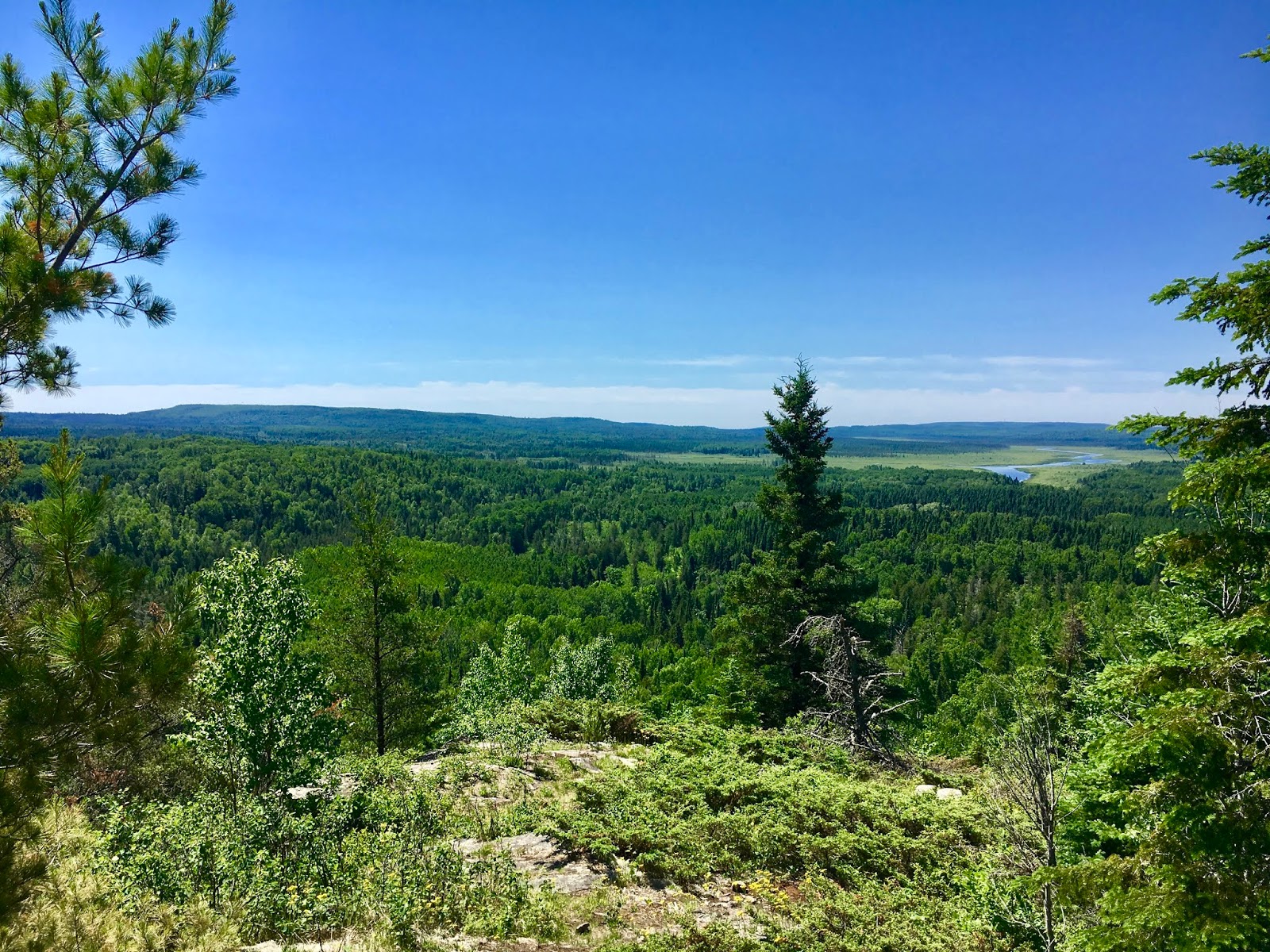
Yes, our feet got pretty wet. But the woods were gorgeous in the snow. In the afternoon, the sun came out -- just in time for our arrival at a scenic waterfall, Wren Falls. When we reached the car, I decided to hike the extra 5.1 miles down to Hwy.169 to knock off a few more miles. Since Doug isn't trying to hike the NCT, he took the car into town and got some coffee to warm up while I was hiking.

One thing Doug did gain on this hike was a trail name: Burr. I gave it to him because when he hiked with me on the Ice Age Trail in the summer, he ended up with so many burrs on him that he threw away his clothing rather than pick them off. Then, on the NCT, it was so cold he was shivering -- Brrr! So it's a fun little pun.

Snowshoe

Miles: 12.2
WI NCT Miles to Date: 12.2
Total NCT Miles to Date: 204.1


Thursday, August 16, 2018

Day 20: Jackson Creek Campsite to Northern Terminus (270-Degree Overlook)

June 21, 2018

I had a lovely breakfast at my campsite this morning, then packed up for the final day. I had less than 10 miles to cover, and the guidebook promised a nice ending. It said I'd initially climb to the top of Rosebush Ridge, the high point on the trail, then descend down to a nice, flat meadow that would take me to the Otter Road Trailhead.

Ha!

It was once again buggy and hot, and wearing that bug jacket made things hotter and more humid. The hike up to the ridge was intense and a difficult way to start the day. There was no view from the ridge (the guidebook mentioned that, but I was hoping I could sort of see something -- nope). 

I was so excited to get to the meadow! But -- oh no! -- it was very overgrown, potholed and difficult to walk on. So being flat really wasn't much of a help. 

The one bright spot was seeing the Andy Lake campsite. I had originally hoped to make it there last night, and was disappointed to have to stay at Jackson Creek. Well, Jackson Creek was a nice campsite and Andy Lake looked TERRIBLE. It was totally overgrown, there was barely a creek let alone a lake, and the benches at the campsite were all dilapidated. If I had pressed on and hiked until 8 p.m. just to get here, I would have been so mad.

When I was nearing the end of the trail, I popped out on another logging road (or some kind of dirt road). There was one blue blaze, but then the road split and there were no markings. You could continue straight or turn right.

At this intersection, a mama grouse rushed at me. It startled me, but I knew what was going on after my run-in with a mother grouse earlier in the hike. Luckily, this time I was on a very wide road versus the narrow, rocky trail I was on before, so it was easy to dart around her.

I turned at the intersection because I did see a pink ribbon hanging from a tree, and I assumed that must be the marker. But after hiking for quite a while and seeing nothing, I was afraid I'd made a mistake. Maybe the pink ribbon was for the loggers. Maybe I missed seeing a blue blaze while trying to dart around the grouse. Just when I was thinking of backtracking, even though I'd probably gone a half-mile, I saw a blaze! It was the only one on that long stretch of road. 

Soon I was at a trailhead. I knew from dropping my car two days ago that I needed to turn left to get to the Otter Lake trailhead. In minutes I was there, where Brian was waiting. We hiked in together to the spur trail to the overlook. Earlier in our trip, he had said this overlook wasn't that inspiring, but I thought it was awesome.

He took lots of photos and sent the drone up, and then I signed the trail register and took a little peek at the Border Route Trail, which heads east about 60+ miles from the spur trail -- picking up where the SHT ends -- and goes through the Boundary Waters area. It looked pretty rough, and Brian said people often get lost on that trail and the next one that hooks in -- the Kekekabic -- because there aren't many volunteers to maintain them. Yikes! I'll have to hike both someday to finish the North Country National Scenic Trail, which piggybacks on all of these trails.

I do know one thing -- I will be hiking those trails in the fall, when the mosquitoes are dead!

So that's my journey. Oh, one more thing. When I got back to my car and started putting away my gear, I found a tick on my sock. I am happy to say I merely flicked it off without a scream or any flailing.

HIKE ON!

Snowshoe

Miles: =9.4
MN NCT Miles to Date: 320.7
SHT Miles to Date: 320.7
Total NCT Miles to Date: 592.4


Day 19: Camp 20 Road to Jackson Creek Campsite

June 20, 2018

Two days from the end. The plan today was for Harriet to lead me to the Otter Lake trailhead -- I knew I could find it myself, but she insisted on meeting me and leading me there -- to drop my car. This is the trailhead where you can take the spur trail to the terminus at the 270 Degree Overlook. After dropping my car, she was going to take me to Camp 20 Road and drop me off for my last two days, which would involve a final night camping.

Well, on the drive there I suddenly started getting really emotional and started to cry a little. It was weird, because I'm ready to stop hiking. The trail has been wonderful, don't get me wrong, but it's also been hard. And sometimes you're just ready to stop. But as always, long-distance hiking is very therapeutic for me, so it's always sad to end. I guess that's what was happening.

Harriet brought me almost to the Camp 20 trailhead. She had told me the previous day that the road there was terrible, and she wasn't kidding. It's only the final 1/4-mile that's bad, but when I dropped my car there yesterday I was afraid I'd pop all of my tires -- the road is filled with enormous potholes. So I had her drop me off before that last stretch. We parted ways and off I went.

As soon as I hit the trailhead/parking area, I knew what I was in for from last night: MOSQUITOES! They were all over the parking area, and worse when I stepped onto the trail. I wasn't hiking long before a met a young man coming the other way. He also had a big bug jacket on like me, and barely stopped to talk because of the mosquitoes.

There were some scenic spots today, namely the Hellacious Overlook. But a couple of nasty areas, too. At one point, after making it through scruffy vegetation and onto a logging road, I knew I had about a mile to hike before heading back into the woods. Nice, because fewer mosquitoes. After hiking not quite a mile, I suddenly saw a blaze to my left. The trail! 

I followed it in but the trail seemed to end almost right away, so I went back out. Maybe it was the old path and they never painted over those initial blazes. But moving forward, I saw a lot of water in the logging road ahead and no blazes. Back into the woods I went. 

I tried hiking farther, and found another blaze or two, but the trail was really overgrown and at one point there really was nowhere to go. Back out onto the logging road again. I finally looked at my guidebook and it said that if the road was flooded, you could take a side trail around the flooded area. OK, so that route to my left was the detour for the flooded road -- except it DIDN'T GO ANYWHERE! I'm guessing it hasn't been maintained in quite a few years.

Luckily, as I prepared to splash through the flooded road, once I got up close you could just walk on the tall grass on the side and get around it just fine. 

Later in the day, when I was closing in on my campsite, I hit a logging area. There was a blaze on a post right as you got out of the forest and onto the logging road, but it was tilted such that it looked like it was pointing you back into the forest, or possibly up the road. Neither option seemed right, but I walked up and down the logging road and then tried some bushwhacking. Nothing. Finally I spied the path -- it just crossed the logging road and continued on. Sheesh! People need to take more care setting those posts.

When I got to Jackson Creek I was excited to set up my tent. Oops! As I was shaking it out of the bag I realized I'd never dried it out after the last time we used it, which was back in Gooseberry Falls and in the rain. The tent dumped out with a great splash of water.

I wiped most of the tent up with my towel and then spread the rain tarp out over a small tree, and everything dried by bedtime. Yay! 

Unfortunately, the mosquitoes made dinner and washing up in the creek unpleasant. So I hurried into my tent on the early side and got a good jump on writing one of my Star Tribune SHT pieces. 

Oh -- there are some really cool, huge, glacial erratics right outside my campsite.

Snowshoe

Miles: =15.5
MN NCT Miles to Date: 311.3
SHT Miles to Date: 311.3
Total NCT Miles to Date: 583


Day 18: Kadunce/Hwy. 61 to Camp 20 Road

June 19, 2018

This was a wistful day. It started out with the famous "lake walk." Most of this trail leads you past Lake Superior from the ridge line, so from up on high. You only walk along the lakeshore twice -- in Duluth a few days into a northbound thru-hike, and then again here, at the end. I felt like the trail was saying good-bye to me. In Duluth, there were huge crowds on the lakeshore, and the feeling was quite festive -- like the trail was welcoming me onto her. Here, you walk along a desolate, pristine section of the lake, which felt like the trail was quietly telling me it was time to get ready to go home.

BTW, Harriet told me a lot of hikers skip the lake walk because the beach is all stones. It isn't easy hiking, but it's not a big deal, either, because it's only a mile or two. People who skip this don't know what they're missing! It's lovely. The water is crystal clear here, and of course the view is endless.

After the lake walk, the trail shoves you back into the woods and heading toward Canada. I quickly passed the North Little Brule River campsite, where I had originally planned to camp last night. It was nice, and I'm sorry I missed it.

I'd had to reconfigure my plans when I shortened my days, plus I took out one or two camping nights that fell on days when we had a lot of rain. I'm starting to enjoy camping, despite the mosquitoes that are so bad come evening that I have to jump into my hammock or tent immediately after washing and eating dinner. But if I have to start camping in rain, too, I might never progress into a hardier camper, which is what I need to be if I truly hike all 11 National Scenic Trails, which is my plan.

Anyway, the route took me into Judge Magney State Park, which was just lovely with more waterfalls. There have been so many on this trail! After that was a section called the Devil's Kettle (1,700 feet), also gorgeous, then another meadow with wildflowers. 

I'm ready to go home, because the trail has been hard on my feet with all the rocks, roots and mud. But I'm a little sad, too.

Snowshoe

Miles: =14
MN NCT Miles to Date: 295.8
SHT Miles to Date: 295.8
Total NCT Miles to Date: 567.5


Sunday, August 12, 2018

Day 17: Grand Marais/Pincushion to Kadunce/Hwy. 61

June 18, 2018

This was a pretty incredible day. Harriet couldn't shuttle me until the evening, so I parked at the Pincushion/Grand Marais trailhead and headed out. The trail is part of a system of ski trails, so it was pretty easy hiking up to Pincushion, a little over one mile away.

The view from Pincushion, a rocky outcrop, is amazing! You can see the lake, shore and inland. I wished I had gone up there at sunrise, or had my breakfast on top. Brian did some photography here, including using the drone. It was just spectacular. (My photos do not do it justice at all.)

From there, the path was pretty pleasant for several hours. Then it got rather overgrown, plus sported lots of downed trees, for at least an hour. The reward? Around lunchtime I emerged on another mountaintop, this time with a meadow bursting with spring wildflowers. I was also treated to expansive views of Lake Superior. It was so beautiful, and I was happy to sit down and have lunch amid such beauty. (Again, photos do not do it justice.)

The afternoon got a little hairier. My phone was dying, and for some reason my 18-month-old battery wasn't working. It wasn't the patch cord; that was brand new. But I couldn't communicate with Harriet about my projected pick-up time and spot, nor with Brian, who needed to find me for our daily photo shoots. But what can you do except keep hiking?

The path wasn't great in many spots. There were lots of roots to walk around, plus some spots with a lot of shale. Ugh. At some point, the battery kicked in and recharged my phone, so I was able to communicate with Harriet. Technology!

At the Kadunce River spur, I opted to continue on the trail instead of going to the Kadunce parking lot. The trail crosses Hwy. 61 about 2 miles after the spur at a rather nondescript spot. When I hit 61, I waited for Harriet. Within minutes, she was there. She is really something!

Snowshoe

Miles: =15.5
MN NCT Miles to Date: 281.8
SHT Miles to Date: 281.8
Total NCT Miles to Date: 553.5


Day 16: Cascade River to Grand Marais/Pincushion

June 17, 2018

Today is my mom's 85th birthday and Father's Day. It's a hard time to be away from home, especially when the cell service is sketchy. But the trail continues to unspool before me.

Harriet didn't want to shuttle me at 8 a.m., so I pushed back the time to 9 a.m. By the time I got on the trail is was 9:40. I'd wanted to start earlier to avoid the rain forecast for the afternoon -- or at least get in as much hiking in the dry weather as possible. Oh well. You take what you get.

The day started off gray with a trail that featured scruffy and overgrown vegetation. There were no views, even though we apparently hit one of the highest points on the trail. After about an hour the sun peeked out and the humidity soared. Ugh. 

Things got better as noon neared. The sun went away and things cooled a tad. The trail started to pass through pretty stands of birch and other woods; the overgrown vegetation fell away. There were a few steep climbs and descents, but mostly lovely walking.

Midway through the day I met a young couple going SOBO. The husband had lost a tooth on the second day eating his wife's too-hard granola, so she called him Toothless. She didn't have a trail name yet, but I'm going to text her and suggest it be Granola. They had two dogs with them, Ursula and Cruella. They must be Disney fans!

It began raining lightly shortly before we met; it actually felt refreshing. The rain stopped by the time I ran into another mostly-thru-hiker, Backtrack, a young woman from Madison! I heard her before I saw her; she was singing a lovely song out loud as she hiked. I asked her about it.

Well, she said she was singing because a while back she'd glimpsed a large, furry animal in the middle of the trail, likely a bear! It did not race off into the woods as bears normally do because it didn't see her. Or hear or smell her, apparently. So she began singing.

I was headed the way of the bear. While I'm not normally afraid of them, as they tend to run away from people, this is cub season and THAT makes me very nervous. So after she left I began singing out loud in the woods. I couldn't think of that many songs, though, so I began practicing my Thousand-Miler book talk out loud for the next 45 minutes or so.

The trail turned onto an ATV path for 2.5 miles, and things began to get unpleasant re: mosquitoes. I've been so lucky this hike, as I haven't had to break out the full bug suit yet, and have only worn the head net on and off. Well, at one point it was horrendous, and I was longing for the bug suit. Mosquitoes were chomping me everywhere, even if I'd just sprayed DEET on myself! Luckily it began to rain again, and that drove away the pests. The rain kept up until I got off the trail. Phew!

So today was an average day scenery-wise. Just a lovely walk in the woods. But that's O.K. Those days are good, too.

Snowshoe

Miles: =13.3
MN NCT Miles to Date: 266.3
SHT Miles to Date: 266.3
Total NCT Miles to Date: 538


Day 15: Caribou Road to Hwy. 45

June 16, 2018

I saw Blueberry at the AmericInn breakfast buffet, and that was a little sad because I knew it was probably the last time I'd see him. I told him rain was coming, and to get out there and set up camp in time. I'm such the mom! But he is young enough to be my son.

That little sadness aside, I headed out to drop my car at Hwy. 45, my end spot. Harriet picked me up. It's her birthday today, and she and her lady friends celebrate for three days. That's my style! As she shuttled me back to my start at Caribou Road, she told me how she and her friends celebrated last night along the Gunflint Trail. Tonight is another fete.

My weather app, which I'm beginning to hate, said no rain until about 4 p.m. Well, after about 90 minutes of hiking it began to rain heavily. Luckily the trees protected me from much of it, but I still got pretty soaked. However, I was able to enjoy some views.

The trail wound up the west side of the Cascade River. I tried to take a spur trail to view the cascade falls, but it was too narrow, rooty and treacherous. I'd already slipped in the mud twice and didn't want to take anymore chances, so I turned around. Rats. Oh well, that's nature.

I ended the hike around 4 p.m., then drove to Grand Marais. I had reservations at the Best Western, and first picked up some groceries. I was so cold and wet, I knew that once I showered I wouldn't want to go out to a restaurant for dinner.

Imagine my surprise to find this Best Western a pretty swanky place. It has a bar and small restaurant, plus the rooms are awesome. I was actually looking forward to camping again, but now I'm not sure! I could stay here for a while.

I tucked in tonight and caught up on a lot of emails and other things. Looking forward to tomorrow, even though more rain is in the forecast.

Snowshoe

Miles: =13.3
MN NCT Miles to Date: 253
SHT Miles to Date: 253
Total NCT Miles to Date: 524.7


Day 14: Oberg Mountain to Caribou Road

June 15, 2018

Wow. What a difference. I started today with such a great mindset, knowing I'd be hiking fewer miles and not be out on the trail until 7 or 8. It was also fun to know that Blueberry and Green Tortuga were taking a zero day today, and  that they were staying at the same place -- the AmericInn in Tofte. In fact, last night I discovered we were right next door to one another!

So while they slept in and resupplied, I headed out to hike 13-ish miles of the trail. Harriet Quarles shuttled me. She turns 74 tomorrow and is quite the colorful character! She is the main shuttle operator for hikers in the northern half of the trail, while another guy handles the southern half.

The trail started out sopping wet, due to heavy rains in the early morning. But I had all of my rain gear on, so it wasn't too bad. Despite the gray skies all day and sodden vegetation, there were some great vistas -- a hallmark of this trail. 

One guy came upon me from behind and hiked past without a glance or grunt -- weird. I didn't see anyone else all day.

The best part of the hike came in the late afternoon, when I reached Agnes Lake. It was gorgeous, plus there were plenty of beavers (and beaver dams) on the lake. I got a great video of one beaver swimming around really close to where I was standing; after a bit he made a huge splash with his tail as he went underwater. It was so cool!

Back at the AmericInn, Blueberry, GT, Brian and I went out to dinner. This was my FIRST real dinner since I started the trail, as Ed and I typically made instant mashed potatoes or some such thing in our motel room -- we'd always be too tired to go out to eat, plus it was always late by the time we got to the motel and finished showering. And on the trail, of course, you're eating trail food. I pigged out on a huge hamburger and fries, plus some wine. I also ordered deep-fried cheese curds so the guys could taste them (they're from the South and Pacific Northwest). 

The guys are slowing their hiking pace, too, so it looks like we won't cross paths again. Boo! But we will always have this experience on the SHT.

Snowshoe

Miles: 11.8
MN NCT Miles to Date: 239.7
SHT Miles to Date: 239.7
Total NCT Miles to Date: 511.4


Saturday, August 11, 2018

Day 13: Fredenberg Creek Camp to Oberg Mountain

June 14, 2018

I thought last night would be a warm one in my hammock. When I first tucked in around 8 p.m., it was stuffy. But after a few hours it cooled down, then got cold. I put on my puffy coat and slid on my rain pants over my long underwear. I had my rain poncho as a blanket, but it didn't cover my entire body. My legs got so cold I couldn't sleep. I finally realized the plastic sheet I used to set my belongings on was actually a large trash bag; I fished it out from underneath my backpack and other belongings, then slid into it. This was kind of gross, as it was pretty dirty, being a ground cloth and all. But I was cold! And it did the trick. It warmed me so that I could fall asleep.

Despite all of the above, it was nice falling asleep in camp. I could hear various animals coming to the creek to drink. By the loudness of their splashing, I could imagine whether it was a deer, fox, raccoon, etc. 

The morning was lovely. I had my coffee and breakfast, then broke camp and hiked out. The trail was very scenic along the Temperance River. As is common along this trail, there were plenty of killer waterfalls to observe. 

Because the Temperance River area is a state park, the trails were pretty well groomed, which was great. I dropped a lot of my heavy camping gear with Brian when I saw him in the park.

And then, the groundhog. Sigh. I was hiking up the other side of the river, making great time, when I spotted a groundhog in the middle of the trail. At first I was excited; I was able to photograph it before it fled.

But then the problem: it DIDN'T flee. Most wild animals will. This guy kept clicking its long front teeth at me. I wasn't sure if it was a mama protecting babies or a rabid animal. I assumed the former initially, but the animal would not move whether I yelled at it, jabbed my trekking poles toward it, backed off for a while, threw sticks at it, etc. When I tried to detour around it in the scrub, it really started clicking its teeth in earnest, and puffed out its fur.

Finally, I had no choice. I pulled out this little vial of mace Ed had given me three years ago and pushed the button. It was old and wet from many soakings through my backpack, but it worked. As soon as the red liquid hit the groundhog, it ran away. I then sprinted down the path for about 100 yards.

Unfortunately, that wrecked my day. It was warm anyway, and from the groundhog it was a hard slog up to Carlton Peak. The signage was poor, and by the time I reached the peak I was irritable and didn't care about the view.

I headed down the peak, knowing I had another trail segment of nearly six miles ahead of me. Luckily those miles were easy, and I made good time back to my car at the Oberg Mountain trailhead.

But I learned an important lesson. I can't keep hiking at this pace. Physically, I can. But mentally, I can't. I don't like rolling into camp (or my motel) at 7 or 8 p.m. It doesn't leave enough time to do anything other than wash up, eat quickly and go to bed. It makes me feel negatively toward the trail, and that's not fair.

So tonight I made a decision. I'm slowing down my hike, even though I'm almost finished. I will end on a positive note, not a sour one.

Snowshoe


Miles: 16
MN NCT Miles to Date: 227.9
SHT Miles to Date: 227.9
Total NCT Miles to Date: 499.6