Wednesday, May 31, 2017

Michigan NCT Day 6: Naomikong Overlook to Taquamenon Lower Falls

May 31, 2017 

It wasn't fun to learn that rain was forecast for the morning after yesterday's misadventures. But you can't expect sunny days every day. 

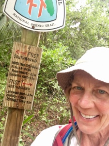
We began hiking west from Naomikong Overlook on Lake Superior's Taquamenon Bay. It was raining. The path wasn't too bad initially, but there were several spots that were pretty overgrown and wet.

The worst part came when the trail pushed us onto what was labeled a dirt road. We envisioned a wide, flat path that was easy to hike. How wrong we were! The rain from the last few days swamped the first quarter-mile or so of the path, so we inched along, stepping on downed logs, circling around in the brush and so on. Our feet got soaked anyway.

Eventually this path became reasonably decent, which meant we still had to skirt huge puddles every 100 yards or so, and the overgrown vegetation still soaked our feet. But at least we could walk somewhat steadily.

The trail next went onto Highway 123, which wasn't that busy, so it was a decent hike. The rain stopped, so we began to dry out. Lunch was at a wayside at the point where the trail hitched west toward Taquemenon Falls. There were even restrooms and garbage cans. Score!

The afternoon was great. The rain stopped and it was cool (48 degrees) and windy, which meant virtually no mosquitoes. We weren't hot and sweating. The scenery was beautiful. We saw a giant crane in the woods -- definitely a novelty. I've only seen them before in farm fields or near water. Saw lots of geese and goslings. We ended the day at 6:30 p.m.

There aren't any restaurants where we're staying (Paradise, Michigan). The closest place is a bar nine miles away. Sounds good, except after hiking all day and then showering, we crash. So we ate snack foods again -- bread, instant mashed potatoes, cheese, nuts. Looking forward to real food tomorrow night, when we stay in St. Ignace.

Snowshoe and Cheese Ed


Tuesday, May 30, 2017

Michigan NCT Day 5: Taquamenon Lower Falls to Culhane Lake

May 30, 2017

Our errors and mishaps are starting to be funny. Today we had roughly 20 miles to hike from Taquamenon State Park's lower falls to Culhane Lake, where we started yesterday.

We got to the state park and I immediately noticed the maps in their kiosks were different -- one was right-side up and one was upside-down. But I didn't take the time to check which one was which because, well, I tend to be a bit hyper and anxious to get going. So we started hiking east from the park instead of west.

Ed and I noticed this after two hours of hiking (we take snack breaks every two hours), which was about six miles in. Fortunately, there was an access road nearby that led to Highway 123, which is the main road with access to various spots on Taquamenon State Park. 

We hiked three miles up to Highway 123. I prayed that we'd find a kind soul who would not only stop for us, but take us right to the spot where my car was parked in Taquamenon State Park (it was .6 miles from Hwy. 123 down a park road to my car). 

Sure enough, a trail angel appeared who drove us there. She wouldn't take money for her kindness, but simply asked that we pay it forward. WE WILL!

So now it was noon. We had hiked nine miles the wrong way. We started off on our intended hike of roughly 21 miles. We ran into trouble right away, in that there was a .9-mile detour on the route. Then, the section that led to the Tequamenon Upper Falls was extremely technical. Our normal three-mile-per-hour pace was much slower. 

Somewhere in here it started to rain.

We hiked about six miles in the rain, plus faced lots of mud, flooded paths and muck. We couldn't move quickly.

I have to add that cell service up here is poor. We couldn't get WiFi and a weather update in two days. The last we'd been able to see, today was supposed to be nice. WRONG.

It rained a lot. I didn't have my rain pants. By the time we hit a road and had 12 miles left to hike, it was after 5 p.m. and we were soaked and the temperature was dropping. If we eschewed the trails and hiked the roads to our car, it would still take us until 8 or 9 p.m. I was worried about hypothermia. 

As we were adding layers and eating a snack, a truck drove up and the driver asked us if we needed help. We swallowed our pride and said yes, our car was 12 miles up the road. And we'd take a ride as many or few miles up the road as they were willing to go.

Again, a trail angel! The man was intending to go halfway up this road, then cut over on another. But he took us all the way to our car. We had to sit in the truck bed, as there wasn't room in the cab. But that was fine, and actually exciting. We tried to pay him for his efforts, but again he said to just pay it forward.

By the time we got to our car, I knew we'd made a very wise decision. The temperature had dropped and it started to pour. We already both felt hypothermic. 

All good!

Snowshoe and Cheese Ed 


Michigan NCT Day 4: Culhane Lake Campground to Muskellonge Lake State Park

May 29, 2017

Oy, the things that can turn you around! So today was a short, 20-mile jaunt from the Two-Hearted River area back west to Muskellonge Lake State Park. I'd given Ed directions for the spot to drop off our car, then began working on my laptop. Again, long story short, Ed missed a key turn and we lost about an hour.
                                            
We started out hiking with mosquitoes in full force. I donned my head-to-toe bug suit for the first time. It worked awesome! Our first several hours of hiking were interesting. We hiked through some clear-cutting areas that looked like moonscapes, and also some areas with storm damage that also looked pretty sobering.

But in the midst of that we were periodically treated to phenomenal views of Lake Superior! The Great Lakes are so amazing. I'm biased, as I grew up along the Lake Michigan shoreline. But honestly, I don't know how anyone can't be amazed by any of our Great Lakes.


It rained on and off during the afternoon. The trail would traipse along the lakeshore, then dip down to a road, then back up again. Some of the roads were sandy logging paths that were really difficult to walk on. The bugs were horrendous, on and off. 


We finished the day at 4:45 – yay! But we had to drive back to our dropped car, and due to the rain and the poor quality of the dirt roads, it took us two hours round-trip (would have been less than half that on paved roads). Oh well, that's hiking!

There is a laundry in this small berg. The owner agreed to open it up at night just to accommodate us. This is what I LOVE about small Midwestern towns!


Snowshoe and Cheese Ed


Michigan NCT Day 3: Muskellonge Lake State Park to Just East of Grand Marais

May 28, 2017

Because we lost our shuttle at the last minute, we realized it would be most efficient to keep hiking westbound. Sort of backwards. We'd drop one car at the western end of our hike, then drive to the eastern end and hike back to the one car. Then drive forward and on to our next lodging.

Today we drove to Muskellonge Lake, ready to hike west back to the spot just east of Grand Marais where we began on Friday. We had heard from trail folks that there has been a lot of erosion along the lakeshore bluffs. This is where the trail often runs, and thus the path disappears in spots wherever a chunk of the bluff erodes completely. The long-term plan is to move the trail about 100 feet (or yards?) in from the bluffs, but for now there are rudimentary detours.

The spot where we were hiking today wasn't yet cleaned up for the season, so we were warned the path might be lost/eroded away in spots. We started off from the Muskellonge Lake State Park in high spirits. We were going to do this! Well … ha! 

We did follow the path very well for the most part, but there was one spot where the trail was eroded away and there happened to be a path back to the road, which was what the map showed. To make a long story short, we headed to the road, walked back and forth a bit, then went back up into the woods and discovered we had to hike past/around the eroded spot a short distance to pick up the real path back to the road. 

All of the back-and-forth cost us about 3 miles, or an hour's hiking. In the midst of this, I must add, it started to rain.

We had another snafu a few hours later, in an area with logging activity. We haven't had a chance to ask locals about this yet, but lots of the logged areas are marked in blue, with blue paint on the trees and blue ribbons hanging from some branches. This is extremely confusing, as you often can't tell if this is NCT markings or logging. So we lost more time in one trail segment due to this.


But all is good. Tonight we are staying in a man's rental home, which is designed like a caboose. It's quite charming. 

Snowshoe and Cheese Ed


Michigan NCT Day 2: Grand Marais to Coves Campsites

May 27, 2017

Ideally, to an orderly, logical person like me, we'd section-hike the NCT in some sequence. (Although section-hiking means you can hike sections of the trail in any order.) But that's not what's happening here, due to a variety of factors. 

What that means for our hike today is that we again headed west, this time from Grand Marais about 25 miles through the Pictured Rocks National Lakeshore and into Beaver Basin Wilderness. 

We were told the path through Pictured Rocks was perfectly signed. Um … not quite. Blue blazes are the sign for the North Country Trail. But in Pictured Rocks, there are wooden sign posts for the trail at the intersection of the trail with major points of interest, but not one blaze otherwise. Okay, that's not too difficult to figure out.

But at the very end of our long, 26-mile day, we were looking for Coves Campsites, from which we'd take a connector trail back to our car. Coves was right after Beaver Creek Campsites, but in between were a wealth of side trails around Beaver Lake. Suffice it to say we never found the path we were looking for, and were told by several others that they found all of the signage confusing. We ended up hiking an extra 2-3 miles, which was tough.


But that's life on the trail! The scenery was gorgeous and we had an excellent day.

Snowshoe and Cheese Ed


Michigan NCT Day 1: East of Grand Marais to Grand Marais

May 26, 2017

And so our section-hike of the North Country Trail begins!

Ed and I drove up to Grand Marais today in two cars, so we could shuttle ourselves on/off the trail. There are some trail angels up here, and a shuttle service, but the U.P. is a large area, and nothing was working out. Part of the reason was that cell service is often nonexistent here, and it's next to impossible to set up or confirm any shuttle arrangements if you can't reach people. But no big deal. If we shuttle ourselves, we're in control of our schedule.

Since it took six hours to get here, and then the time zone flipped from Central to Eastern and we lost another hour, we weren't able to start hiking until about 4:30. All we had planned was an easy four-miler from a spot just east of Grand Marais into town. Most of this hike was on the road, but it was a little-traveled road so it was pleasant.


Grand Marais is quite small, but it has a beautiful beach and cove. According to signage, "Marais" means refuge (it's French, from early explorers), and that's just what the cove looked like. That night we had great whitefish tacos at a little brew pub. It was graduation day; three kids graduated from the local high school, including twins. We stayed at Hilltop Cabins.

Four miles down, about 4,596 to go!

Snowshoe and Cheese Ed


Thursday, May 25, 2017

Day 34 / 7: Royal Trails to Clearwater Recreation Area

May 21, 2017

I had to catch a 2:55 p.m. flight today out of Orlando. No problem; I just had 10 miles to hike from Royal Trails to Clearwater Recreation Area. 

I got to Royal Trails, which is a sprawling subdivision, around 6:30 a.m. It was so nice and cool at this time of day, especially after starting so late most mornings. The first 1.2 miles of the hike were on paved roads in the subdivision, but then the path pushed me onto trails. Ahhh!

The first portion of the trail quickly led to sand, which isn't the greatest for hiking. But a fair portion of the sand was reasonably compact, so it wasn't too tough.

In one area the trail dipped into this jungle/swamp-like section, which was a bit difficult to walk through. Thank goodness Florida is having a dry spring. There was not a drop of water here, although the area was very damp, and there was not a single bug. I'm sure this section is horribly buggy when it's wet.

After this spot, I was on another sandy trail studded with animal prints. All of a sudden I saw a few that were very distinctive -- bear prints! Yikes! My last day on the trail in March, I saw two cubs. Would this happen again? 

Not quite. Not more than five or 10 minutes after seeing the prints, I rounded a corner and saw a black bear. Luckily, it immediately ran away. But I had to go right past the spot where it had rushed into the woods, so I began talking and singing. I kept up the nonsensical chatter for about 10 minutes before I relaxed enough to quit.

Near the end of my trek, the path went through a large cattle field owned by the Boy Scouts. You had to hike blaze-to-blaze here, as there was no set path. The blazes were pretty far apart, and sometimes I couldn't spot the next one. But it was clear that you had to cut across the field, so if you just kept walking you'd soon spot it. 

My friend/Trail Angel Tammy picked me up in the Clearwater Rec parking area. I'd met her last March when I started here, and she graciously shuttled me two days. Today she shuttled me back to Royal Trails. From there, she and a friend and Tammy's grandson were going blueberry-picking.

I made it back to my hotel with just enough time to shower, then caught my flight home.

Now I'll be waiting until November or December to pick up where I left off in March, at St. Marks up in the eastern panhandle. But I won't be idle. I'll be hiking my first portion of the North Country Trail in late May/early June, and then thru-hiking the (short) New England National Scenic Trail this September. 

Stay tuned!

Snowshoe


Saturday, May 20, 2017

Day 33 / 6: Soldiers Creek Park to Royal Trails

May 20, 2017

I think long-distance hiking is trying to teach me a lesson: patience. Every day, something seems to go wrong. But every time something goes awry, I'm less shaken or annoyed by it than I would have been a year or two or three ago. In the grand scheme of life, if my rental car gets locked in a county park or I accidentally hike 26 miles instead of 24, is that really such a big deal?

So guess what happened to me today? My schedule called for hiking from Soldiers Creek Park to Royal Trails, a total of 24.3 miles. The weather was pretty intense again today -- highs in the low 90s with lots of sun. I couldn't find a shuttle or cab that could bring me from one end of the trail to the other, so I had a dilemma. But then the answer seemed easy. The first half of the hike was along a recreational trail and roads, while the last half was trails. I'd park at the trailhead where the second half of the hike began, then hike out and back. That way I'd hike the same mileage, and hike every trail mile (the important stuff). 

But I did the math the previous night, when I was tired. I thought that my out-and-back hike on the Florida Trail was 3 miles short of the road walk I was skipping, so I decided to hike 3 more miles on side trails so I'd get the exact same mileage. Perfect!

And so I began my day. There was a huge search-and-rescue training going on at the trailhead at Lower Wekiva, so it was hard to find a parking spot. About 3 hours into my hike, I ran into Lou, Betty and Yvonne, hikers from the Florida Hiking Syndicate Facebook page. It was so nice to have hiking buddies! We hiked together for about an hour. They were ending at the Cassia trailhead, while I was continuing on to Royal Trails, then turning around the repeating the hike with some extra loops to get in the required mileage.

After hiking on the blue loop and nearing my detour on the white loop, the timing seemed to be off. I figured I'd finish after 7 p.m., which seemed quite late, despite my slower pace in the heat.

I re-calculated the mileage and discovered I'd erred. It's too convoluted to explain, but suffice it to say I over-hiked today by two or three miles. But, as Beerman says, all good!

Snowshoe


Friday, May 19, 2017

Day 32 / 5: Chuluota Wilderness Area to Soldiers Creek Park

May 19, 2017

I love hiking because every day is so different and wonderful in its own way, even if it's difficult.

So today I started out from the Chuluota Wilderness Area parking lot. I first dropped my car at Soldiers Creek Park, my ending point, where a taxi driver picked me up. He said it was fine to leave my car there.

During our shuttle back to my starting point, I quizzed the driver on those spiders I saw yesterday. He said they are banana spiders, not poisonous, although they do bite. He said they weave ginormous webs (saw those!) and that they're active now but disappear by fall.

I started off today at 8:30 a.m. Still late, compared to my Ice Age Trail forays. But here it's different. At least in May. If you start really early, the temps are lower but the humidity is higher. So it's almost better to start later. 

Anyway, I thought the first 2 miles were on Curryville Road, then the trail cut in when Curryville hit a T intersection. Wrong; the trail cut in part-way up to the intersection. But I missed it, because I wasn't looking for it. Luckily when I hit the T intersection, there was a spur trail onto the FT just up the road. So I got back on pretty quickly.

The morning was warm and humid, yet cloudy with a little wind. So it wasn't horrible for hiking, yet the humidity definitely slowed me down. The one scary time came when I nearly walked right into a banana spider and its web. It would have been right at mouth level! Thank goodness I saw it in the nick of time.

At 2 p.m. I finished the trails and popped out onto the roads. The rest of the day (until 6:30 p.m.) was on roads around Oviedo and Winter Park, and most of those roads were a bike path. Unfortunately the signage here was sparse, and I got off the trail a few times.

I used my sun umbrella here, and switched to a long-sleeved shirt to protect my arms from more sunburn. The highlight was stopping at a gas station/mini mart and purchasing a small ice cream cup AND a cup of ice for my water bladder. Cold water helps so much on hot days! 

This trip I also made up a few gallons of Chrystal Lite lemonade. That has worked well for me; I drink it in between the water. 

So I got back to Soldiers Creek Park at 6:30 p.m., excited that my lodging for the night was just 8 minutes away, and that I had ended at 6:30. But then I saw I was locked in! The county park had closed, and both exits were barricaded. I called the police, who notified the sheriff. A deputy came out and said they did not have keys to the locks, and the park officials would not let them (or the fire department) have keys for emergencies. I said, "I'd think you could just demand keys!" and he said, "Yeah, you'd think!" Luckily he found a bike path wide enough for me to drive on and I escaped the locked parking lot after 30 minutes.

Hiking is always an adventure.

Snowshoe


Thursday, May 18, 2017

Day 31 / 4: Tosohatchee State Preserve to Chuluota Wilderness Area

May 18, 2017

Another late start today: 9:30 a.m. But while it was still hot out, I was again blessed with wind and low humidity. 

I was worried about ticks and chiggers in the Tosohatchee State Preserve, but due to this year's dry "rainy season" there were no bugs. 

The first part was on sandy footing, so that was hard. But then the trail went into the woods and was delightful. For a while, anyway. Then I started walking into spider webs. Those are pretty common on any hikes, but these were made of some super-sticky webbing that was pretty gross. Even worse, a lot of the webs had spiders in them. The spiders were yellow and black and maybe red, and vertical. That is, they weren't fat, but tall and lean. 

I began swinging my sticks in between any trees that were close together on either side of the path, as those were the areas most likely to have webs. It was mentally taxing, as you had to keep your eyes peeled every second. 

Then suddenly the webs were gone and the trail was beautiful again. Until they resumed! This time there were more webs, and I saw one spider that was probably five inches long. ICK! 

But again, they disappeared when the trail opened up. The last 6 or so miles were very enjoyable. The terrain was prairie-like, then through a proscribed-burn area where the palmettos were regenerating, then through a very serpentine path, and so on. The terrain kept changing and everything was gorgeous. It also helped when the sun and heat went down.

It was a long day, due to the late start; I didn't finish until 7:30 p.m. But I'm so thankful to be able to explore such a beautiful part of our nation.

Snowshoe


Wednesday, May 17, 2017

Day 30 / 3: Hwy. 419 (3 Miles In) to Tosohatchee State Preserve

May 17, 2017

We got a late start today for various reasons, so I didn't start walking today until 9:40 a.m. It was another hot, breezy day. The humidity wasn't too bad.

Today's 25-mile hike was all on roads. Now, many people hate road walks. I don't necessarily. Well, I don't care for hikes on busy highways. But quieter roads are fine.

I started off on 419 and then Nova Road. Both roads had steady traffic, but it was light. I decided to make the hike fun by seeing what I could find along the shoulder/grass where I was walking. Here are some of the things I spied.


  • Five work gloves, one fancy glove, one purple elastic glove and one fancy plastic glove
  • One pair of coral swim trunks
  • A paintbrush
  • Three hardcover library books. One was a neat how-to-sketch-kids book.
  • A turtle
  • A raptor
  • A dead turkey
  • A dead black snake with its mouth open
  • A dead red-on-yellow, kill-a-fellow snake (coral?)
  • A dead possum
  • A Starbucks cup (Starbucks patrons don't usually litter)
  • A really, really long clump of string/rope
I forget everything else, but it was an interesting way to pass the day.

The last 6.6 miles were along a busy state highway, and that was not too pleasant. The wind died down and I was frying in the sun, no matter how much sunscreen I applied. As soon as Ten-Miler drove up and I got my sun umbrella, it got windy again and the wind turned it inside out.

My final mile was along sleepy Yates Road, which led into the start of the Tosohatchee State Preserve. I'm really excited to hike there tomorrow, although Sandra Friend said there's been a tick and chigger hatching. I'll have to start off in my bug suit and see how bad it is.


Tuesday, May 16, 2017

Day 29 / 2: Forever Florida to Hwy. 419 (3 Miles In)

May 16, 2017

The thought was to start hiking early every day to avoid the worst heat. Except Sunday night I had only gotten 2 hours of sleep in order to make my flights, so I really needed to sleep in. So 10-Miler and I didn't hit the trail until just before 9 a.m.

The morning hiking was gorgeous. I was in the Forever Florida land, so much of the hiking was on wide roads used by the group's tourist vehicles. Some areas got pretty sandy, but every time I was getting annoyed by slogging through the sand the land changed and the footing was firmer.

I met an employee of Forever Florida at one point. He said this was the driest spring in Florida since the 1800s. Normally the area I was walking on would have many puddles and my feet would definitely be wet, he said. Also, there would normally be a field of yellow Bachelor's Buttons now, but the drought left them unable to bloom.

Sometime around noon until maybe 3 p.m., the trail got a lot scruffier. This was after leaving the Forever Florida territory. Some areas had had prescribed burns, others were just scruffy. One area was very sandy, and you couldn't make out the trail. Everything and nothing looked like trail. So I had to hike blaze-to-blaze. Another area was filled with dead palmettos, which made surprisingly tough footing. I tripped on a lot of them.

10-Miler met me with about 3 miles left to go. She was really struggling with the heat. We both ran out of water, despite having packed a lot.

Back at her truck, I jogged the remaining 5.3 road miles left. It was a hot day, for sure. But once again there was enough wind and low humidity, so it wasn't that awful. And -- YAY! -- no ticks again!

Judy and I are staying at a motel in Melbourne. La Quinta. It's very nice.