I had a lovely breakfast at my campsite this morning, then packed up for the final day. I had less than 10 miles to cover, and the guidebook promised a nice ending. It said I'd initially climb to the top of Rosebush Ridge, the high point on the trail, then descend down to a nice, flat meadow that would take me to the Otter Road Trailhead.
Ha!
It was once again buggy and hot, and wearing that bug jacket made things hotter and more humid. The hike up to the ridge was intense and a difficult way to start the day. There was no view from the ridge (the guidebook mentioned that, but I was hoping I could sort of see something -- nope).
I was so excited to get to the meadow! But -- oh no! -- it was very overgrown, potholed and difficult to walk on. So being flat really wasn't much of a help.
The one bright spot was seeing the Andy Lake campsite. I had originally hoped to make it there last night, and was disappointed to have to stay at Jackson Creek. Well, Jackson Creek was a nice campsite and Andy Lake looked TERRIBLE. It was totally overgrown, there was barely a creek let alone a lake, and the benches at the campsite were all dilapidated. If I had pressed on and hiked until 8 p.m. just to get here, I would have been so mad.
When I was nearing the end of the trail, I popped out on another logging road (or some kind of dirt road). There was one blue blaze, but then the road split and there were no markings. You could continue straight or turn right.
At this intersection, a mama grouse rushed at me. It startled me, but I knew what was going on after my run-in with a mother grouse earlier in the hike. Luckily, this time I was on a very wide road versus the narrow, rocky trail I was on before, so it was easy to dart around her.
I turned at the intersection because I did see a pink ribbon hanging from a tree, and I assumed that must be the marker. But after hiking for quite a while and seeing nothing, I was afraid I'd made a mistake. Maybe the pink ribbon was for the loggers. Maybe I missed seeing a blue blaze while trying to dart around the grouse. Just when I was thinking of backtracking, even though I'd probably gone a half-mile, I saw a blaze! It was the only one on that long stretch of road.
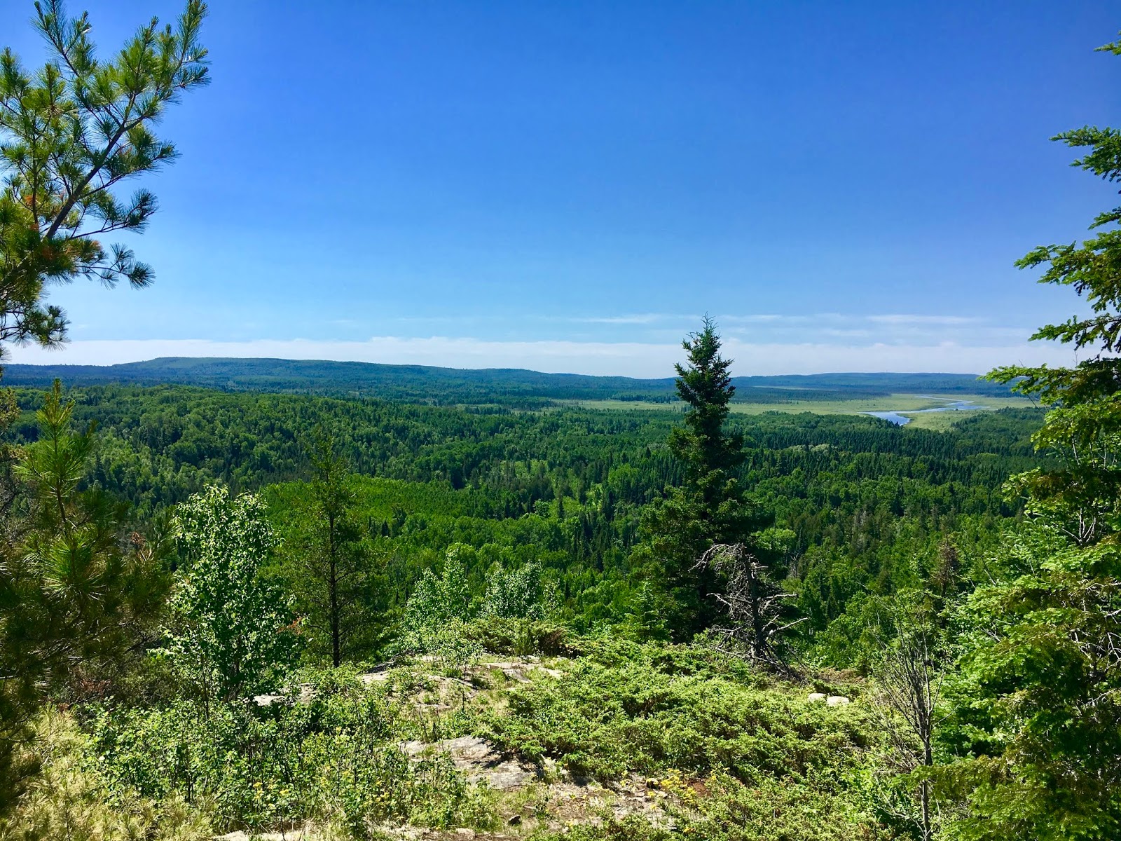
Soon I was at a trailhead. I knew from dropping my car two days ago that I needed to turn left to get to the Otter Lake trailhead. In minutes I was there, where Brian was waiting. We hiked in together to the spur trail to the overlook. Earlier in our trip, he had said this overlook wasn't that inspiring, but I thought it was awesome.
He took lots of photos and sent the drone up, and then I signed the trail register and took a little peek at the Border Route Trail, which heads east about 60+ miles from the spur trail -- picking up where the SHT ends -- and goes through the Boundary Waters area. It looked pretty rough, and Brian said people often get lost on that trail and the next one that hooks in -- the Kekekabic -- because there aren't many volunteers to maintain them. Yikes! I'll have to hike both someday to finish the North Country National Scenic Trail, which piggybacks on all of these trails.
I do know one thing -- I will be hiking those trails in the fall, when the mosquitoes are dead!
So that's my journey. Oh, one more thing. When I got back to my car and started putting away my gear, I found a tick on my sock. I am happy to say I merely flicked it off without a scream or any flailing.
HIKE ON!
Snowshoe
Miles: =9.4
MN NCT Miles to Date: 320.7
SHT Miles to Date: 320.7
Total NCT Miles to Date: 592.4


No comments:
Post a Comment